
Madrid day trip route planner
Sierra de Guadarrama National Park: Choose the Right Route for a Madrid Day Trip
Plan a safe and realistic Guadarrama day trip from Madrid. Use this guide to compare the main areas, choose a route by time, level and season, check transport options and avoid the common mistakes of mountain day trips.
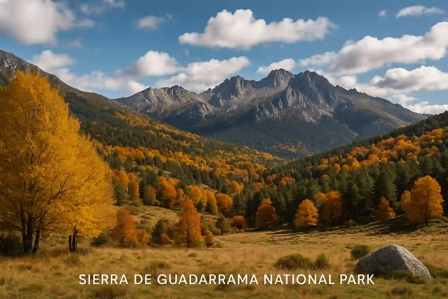
Quick answer
How to choose a Sierra de Guadarrama day trip from Madrid
Choose your Sierra de Guadarrama plan by time budget, fitness level, transport and season. For an easier nature day, start with Fuenfría or Cercedilla. For classic mountain views and lagoons, choose Peñalara or Rascafría. For granite landscapes, climbing atmosphere and dramatic rock formations, choose La Pedriza.
The safest planning path is: area → route profile → transport → weather → safety check → plan B. Do not choose a route only because it looks beautiful on photos.
Shorter forest walks, lower exposure, better transport and simple return planning.
More elevation, stronger weather impact, earlier start and better equipment needed.
Summer means heat and early starts. Winter means snow, ice and stricter route choice.
Book a guided trip if you want transport, route choice and timing handled for you.
Mini route finder
Which Guadarrama route fits your day?
Use these three questions before choosing a route. They reduce the risk of picking a route that is too hard, too far from your start point or wrong for the season.
How much time do you have?
- 4–5 hours: choose an easier forest or viewpoint plan.
- Full day: choose Peñalara, La Pedriza or a guided mountain day.
- Evening return needed: keep public transport and daylight conservative.
What is your hiking level?
- Beginner: lower routes, forest paths, clear signage.
- Intermediate: longer walks, moderate elevation, rocky sections.
- Experienced: higher terrain, exposed weather, early start.
How will you get there?
- Public transport: choose gateway towns carefully.
- Car: check parking pressure and access restrictions.
- No logistics stress: consider a guided day trip.
Area comparison
Main Guadarrama areas: where is the best day trip for you?
Guadarrama is not one single hiking spot. It is easier to plan when you treat the park as several gateway areas, each with a different character, access logic and season risk.
| Area | Best for | Access from Madrid | Typical level | Season / risk factor |
|---|---|---|---|---|
| Fuenfría / Cercedilla | Forest walks, easier day trips, first Guadarrama visit. | Public transport-friendly compared with many mountain start points. | Easy to medium. | Winter snow, weekend crowds, return timing. |
| Peñalara / Rascafría / Cotos | Classic mountain views, lagoons, highest peak area. | Car or careful bus/train planning depending on start point. | Medium to hard. | Snow, ice, wind, access limits, exposed weather. |
| La Pedriza / Manzanares el Real | Granite rocks, photography, climbing atmosphere, adventurous feel. | Bus or car, but parking and access planning matter. | Medium, sometimes hard depending on route. | Heat, rocky terrain, route-finding, access pressure. |
| Navacerrada / Siete Picos | Classic mountain ridge, views, more athletic hiking. | Car or public transport depending on current services. | Medium to hard. | Wind, snow, ice, weekend demand. |
| El Paular / Lozoya Valley | Culture + nature, monastery, valley walks, calmer pacing. | Car or bus planning from Madrid. | Easy to medium. | Weekend demand, route length, seasonal heat/cold. |
Curated route profiles
Routes by visitor profile: choose by effort, not only by scenery
Use these route profiles as planning frames. Check exact distance, elevation, access and trail conditions before departure, because weather and local restrictions can change the real difficulty.
Fuenfría / Cercedilla forest route
Usually easiest choiceBest for a first Guadarrama day trip, forest scenery and lower-risk planning from Madrid.
Peñalara lagoons and high mountain route
Check weather firstBest for iconic Guadarrama scenery, higher terrain and a stronger mountain feeling.
La Pedriza and Manzanares el Real
Route choice mattersBest for dramatic rock formations, photography, scrambling atmosphere and a more adventurous landscape.
Navacerrada / Siete Picos style route
Wind and snow checkBest for a more athletic day with views, ridge feeling and classic mountain terrain.
El Paular / Lozoya Valley route
Good slower planBest if you want a softer day with monastery atmosphere, valley scenery and less athletic pressure.
Guided Guadarrama day trip
Easiest planningBest if you prefer transport, route selection and timing handled by a guide.
Transport from Madrid
How to get there from Madrid: public transport, car or guided tour
Transport is part of the route decision. A beautiful route can be a bad day trip if the start point is hard to reach, parking is full or the return connection is weak.
Public transport
- Best for Cercedilla-style plans and some gateway towns.
- Check first and last return connections before choosing a route.
- Do not rely on flexible return timing in remote areas.
Car
- Gives more flexibility for Peñalara, La Pedriza and valley routes.
- Check parking pressure, weekend demand and access rules.
- Arrive early in popular areas.
Guided tour
- Best if you do not want to manage transport and route choice.
- Good for short Madrid stays and mixed fitness groups.
- Check duration, route difficulty, language and what is included.
Transport mistake to avoid
Do not choose the route first and think about transport later. For a Madrid day trip, choose the area and route together with the return plan.
Protected area rules
Rules, protection and behaviour in the National Park
Sierra de Guadarrama is a protected mountain area. Rules exist to protect wildlife, vegetation, water, trails and visitors. Always check current park information before departure, especially if you plan a high route, weekend visit or winter hike.
Park behaviour checklist
- Stay on marked trails
- Take all rubbish back with you
- No fire or careless smoking
- Respect wildlife and quiet zones
- Check dog/leash rules before going
- Do not disturb water areas or sensitive habitats
- Check drone restrictions before using one
- Follow access limits and visitor rules
- Use official parking and transport guidance
- Leave earlier if weather or daylight becomes unsafe
Safety before hiking
Safety check before you go: weather, gear, daylight and plan B
The most common planning error is treating Guadarrama like a city park because it is close to Madrid. It is mountain terrain. Weather, snow, heat, wind and daylight can change your day quickly.
Weather and season
- Check temperature, wind, rain and storm risk.
- In winter, check snow and ice before higher routes.
- In summer, start early and carry enough water.
Equipment
- Wear proper walking or hiking shoes.
- Bring layers, sun protection and water.
- Use an offline map if you leave easy paths.
Turnaround logic
- Set a latest turnaround time.
- Turn back if weather changes.
- Tell someone your route if hiking independently.
Abort or change the route if:
- Storms or strong winds are forecast
- Snow or ice appears and you lack equipment
- You started too late for daylight
- You have less water than planned
- The route feels harder than expected
- Return transport is uncertain
- Someone in the group is tired early
- Access or parking rules block your plan
Season planning
Best season for Sierra de Guadarrama routes
Spring
- Good for hiking and greener landscapes.
- Higher areas can still have cold or wet conditions.
- Check trails after rain or late snow.
Summer
- Start early and avoid exposed midday heat.
- Carry more water than for a city walk.
- Choose shaded or higher routes carefully.
Autumn
- Often one of the best seasons for day hiking.
- Good light, cooler temperatures and strong forest atmosphere.
- Check daylight as days get shorter.
Winter
- Higher routes can involve snow, ice and wind.
- Choose conservative routes unless you have mountain experience.
- Check conditions and equipment before leaving Madrid.
Weekends
- Popular access points can become crowded.
- Parking and transport need earlier planning.
- Have a second area or shorter Plan B.
Bad weather
- Prefer valley routes, village stops or cultural add-ons.
- Avoid exposed ridges and high terrain.
- Choose a guided option if unsure.
10-minute planning flow
Fast plan: from idea to realistic Guadarrama day route
Use this sequence if you want a practical route quickly without getting lost in endless route lists.
Choose area
Fuenfría, Peñalara, La Pedriza, Navacerrada or Lozoya Valley.
Choose effort
Easy, medium, hard or guided. Be honest about your group.
Check transport
Public transport, car, parking, return time or guided pickup.
Check weather
Wind, heat, storms, snow, ice and daylight.
Set Plan B
Shorter route, lower valley, village stop or guided option.
Copy checklist for your phone
Guadarrama day trip checklist:
- Area chosen:
- Route chosen:
- Start point:
- Public transport / car plan:
- Latest return time:
- Weather checked:
- Water packed:
- Shoes / layers packed:
- Offline map ready:
- Access / parking checked:
- Plan B:
- Turnaround time:
Highlights
What you can see in Sierra de Guadarrama
Sierra de Guadarrama combines mountain views, pine forests, granite landscapes, lagoons, wildlife, old routes, villages and cultural stops. The right highlight depends on your area choice.
Peñalara
The highest and most alpine-feeling part of the park, with classic mountain scenery and lagoon routes.
La Pedriza
Granite rock formations, dramatic shapes, climbing culture and strong photography potential.
Fuenfría
Forest routes, historic paths and a better choice for easier day-trip planning.
El Paular
Monastery, valley atmosphere and a softer culture-plus-nature route near Rascafría.
Wildlife
Birds of prey, mountain goats, deer and other wildlife can appear, but keep distance and do not disturb animals.
Mountain villages
Gateway towns make the trip easier for food, transport, short walks and Plan B options.
Travel Spanish
Spanish nature vocabulary for Guadarrama
Guadarrama is a useful place to learn Spanish nature and hiking vocabulary because the words connect directly to the landscape.
Continue planning
More MundoDele guides for Spain travel and Spanish learning
Connect your Guadarrama day trip with Madrid travel planning, Spanish learning and cultural context.
FAQ
FAQ: Sierra de Guadarrama National Park day trips
Which route is best for a first Guadarrama day trip from Madrid?
For a first visit, choose a lower-risk area such as Fuenfría / Cercedilla or a guided day trip. These options are easier to plan than high mountain routes if you are new to the park.
Can I visit Sierra de Guadarrama by public transport?
Yes, but it depends on the area. Cercedilla-style plans are usually easier for public transport than remote high mountain start points. Always check return connections before choosing the route.
Which season is best for hiking?
Spring and autumn are usually the easiest seasons. Summer requires heat planning and early starts. Winter can bring snow and ice, especially in higher areas.
Do I need a guide?
Not always. Independent hiking works if you have a clear route, proper gear, weather awareness and a return plan. A guide is useful if you want transport, route choice and safety logic handled for you.
What is the biggest planning mistake?
The biggest mistake is choosing a beautiful route without checking level, transport, season, weather and return timing. Always choose the route and logistics together.
What should I bring?
Bring proper shoes, water, layers, sun protection, an offline map, charged phone and enough time for return transport. For higher or winter routes, check whether extra equipment is necessary.
Is Guadarrama suitable for families?
Yes, if you choose the right area and route. Forest walks and shorter valley routes are better than high mountain routes for families with children.